Trusted by pet owners, ethical hunters, and landowners across the region
About Aerovation
We Bring Certainty When You Need It
Most
We know what it feels like to be desperate for answers and terrified you’re not doing enough. That’s why we founded Aerovation — to give families, hunters, and landowners the tools and expertise they need during their most stressful moments.
Every week, we help owners, hunters, and land managers get the
clarity they need through smart thermal searches, licensed piloting,
and a calm, compassionate approach that gets results. We don’t
just fly drones — we bring peace of mind.
Our Mission
To provide rapid, professional drone-based search and recovery
services that deliver real answers — not regrets.
Why Our Approach Works
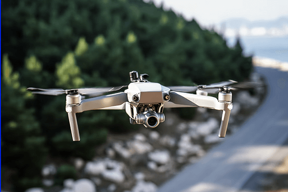
Advanced Thermal Technology
Our high-resolution thermal cameras
detect heat signatures in complete
darkness or dense terrain — so nothing
is missed, day or night.
Licensed & Experienced
All our pilots are FAA-licensed
professionals with extensive search
and recovery experience — not hobby
flyers.
Rapid Response
We understand that time is critical. Our
team deploys quickly to maximize your
chances during the most crucial
window.
GPS Precision
Every detection is marked with precise
GPS coordinates — no wandering or
guessing about where to search next.
Strategic Search Planning
We analyze terrain, weather, and animal
behavior to create targeted search
patterns that maximize coverage and
success rates.
Compassionate Support
We provide calm, respectful guidance
during your most stressful moments —
because we understand what you're
going through.
Successful Searches
0+
Emergency Response
24/7
Client Satisfaction
0%
How It Works
1
Schedule a Discovery Call
We learn what happened, where, and when — then map out your best next move.
2
We Launch the Search
Our licensed pilot deploys thermal drone technology to scan your area with precision.
3
You Get Clarity and Closure
We guide you to the animal if found — or give you real answers if not.
Our Recovery & Aerial Services
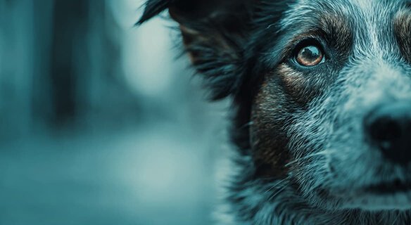
Dog Recovery
Lost dogs located using thermal drones in thick brush,
neighborhoods, and rural terrain. We understand the unique
behavior of lost dogs and adapt our search patterns
accordingly.
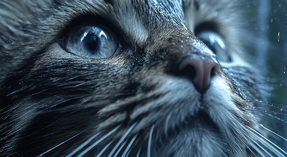
Cat Recovery
Specialized thermal searches for missing cats who often
hide in elevated positions or dense cover. Our technology
can detect their heat signature even when they're
motionless and silent.
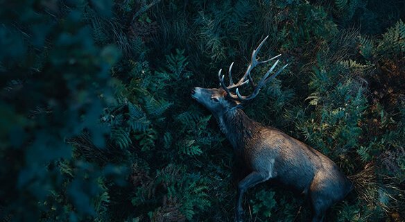
Deer Recovery
Ethical recovery for wounded or unrecovered deer — even
hours after the shot. Our thermal technology can spot heat
signatures that the naked eye would miss in dense cover.
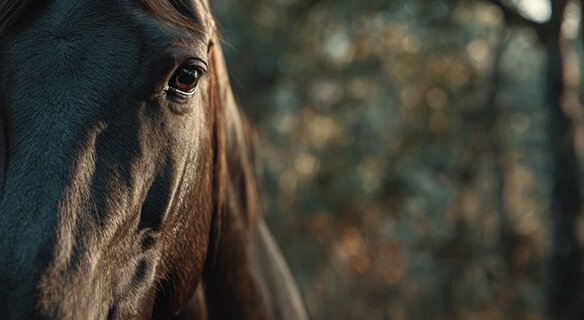
Horse Recovery
Rapid aerial searches for missing or escaped horses across
large properties and open terrain. Our drones can cover vast
acreage quickly, locating your horse before they travel too
far or encounter danger.
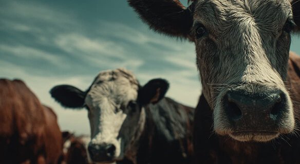
Cattle & Livestock Recovery
Locate missing cattle or livestock quickly across large
acreage. Save days of riding and searching by using aerial
thermal perspective to scan hundreds of acres in minutes.
What You Get With Every Search
Comprehensive service designed for results and peace of mind.
Thermal drones
Licensed drone pilots
Rapid deployment
Night search capability
GPS mapping
Live progress updates
Search planning expertise
Post-search report
Discreet operation
Compassionate support
Frequently Asked Questions
What if the drone doesn't find anything?
Lorem ipsum dolor sit amet, consectetur adipiscing elit. Ut elit tellus, luctus nec ullamcorper mattis, pulvinar dapibus leo.
How much does this cost?
Lorem ipsum dolor sit amet, consectetur adipiscing elit. Ut elit tellus, luctus nec ullamcorper mattis, pulvinar dapibus leo.
Is this legal in my area?
Lorem ipsum dolor sit amet, consectetur adipiscing elit. Ut elit tellus, luctus nec ullamcorper mattis, pulvinar dapibus leo.
Can't I just fly my own drone?
Lorem ipsum dolor sit amet, consectetur adipiscing elit. Ut elit tellus, luctus nec ullamcorper mattis, pulvinar dapibus leo.
Is it already too late to try this?
Lorem ipsum dolor sit amet, consectetur adipiscing elit. Ut elit tellus, luctus nec ullamcorper mattis, pulvinar dapibus leo.
Don't Wonder What Could Have
Happened
Whether it’s a pet, a deer, or livestock — waiting only lowers the odds. Let’s use the right tools, the right plan, and act while time is still on your side.